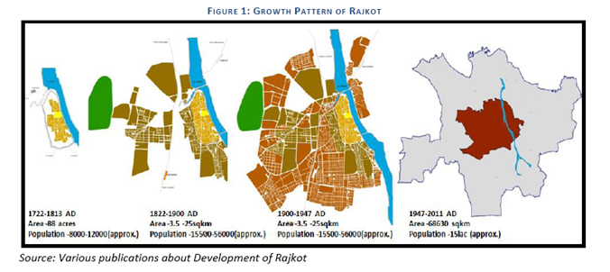
 The Rajkot Urban Development Authority (RUDA) is constituted under section 22 of the Gujarat Town
Planning & Urban Development Act, 1976 on
30th januarys 1978. The total area covered was 686.30Sq. Kms. covering 48
villages in the periphery of the Rajkot Municipal Corporation including the area of Rajkot
Municipal Corporation i.e. 161.86 Sq.Kms.
The Rajkot Urban Development Authority (RUDA) is constituted under section 22 of the Gujarat Town
Planning & Urban Development Act, 1976 on
30th januarys 1978. The total area covered was 686.30Sq. Kms. covering 48
villages in the periphery of the Rajkot Municipal Corporation including the area of Rajkot
Municipal Corporation i.e. 161.86 Sq.Kms.

Rajkot Urban Development Authority,
Shri Chimanbhai Patel Vikas Bhavan,
Post Box No.238, Jamnagar Road,
Rajkot Gujarat, India.